SectorCultural Institutions, Public Sector, Science
TagsWebGIS, Maps
Virtual Map Forum
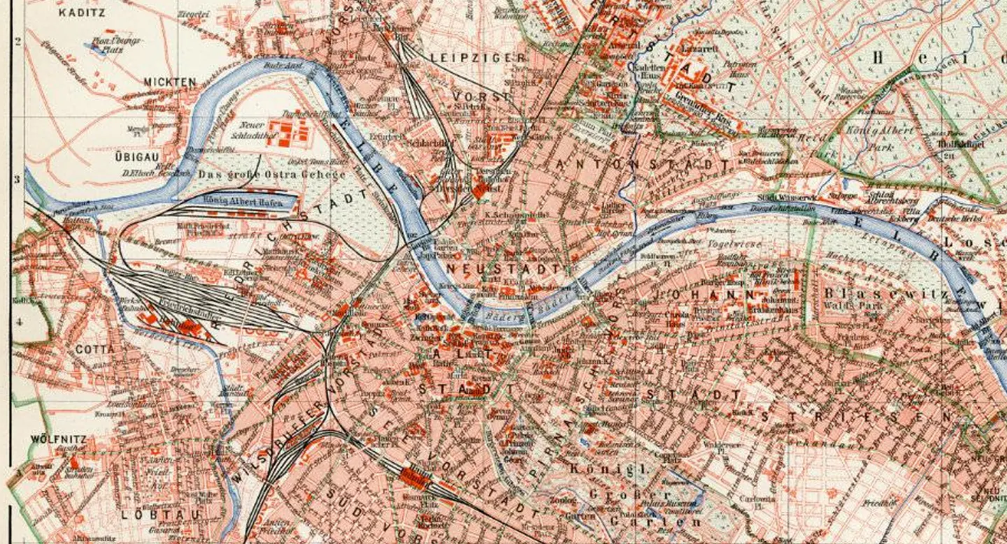
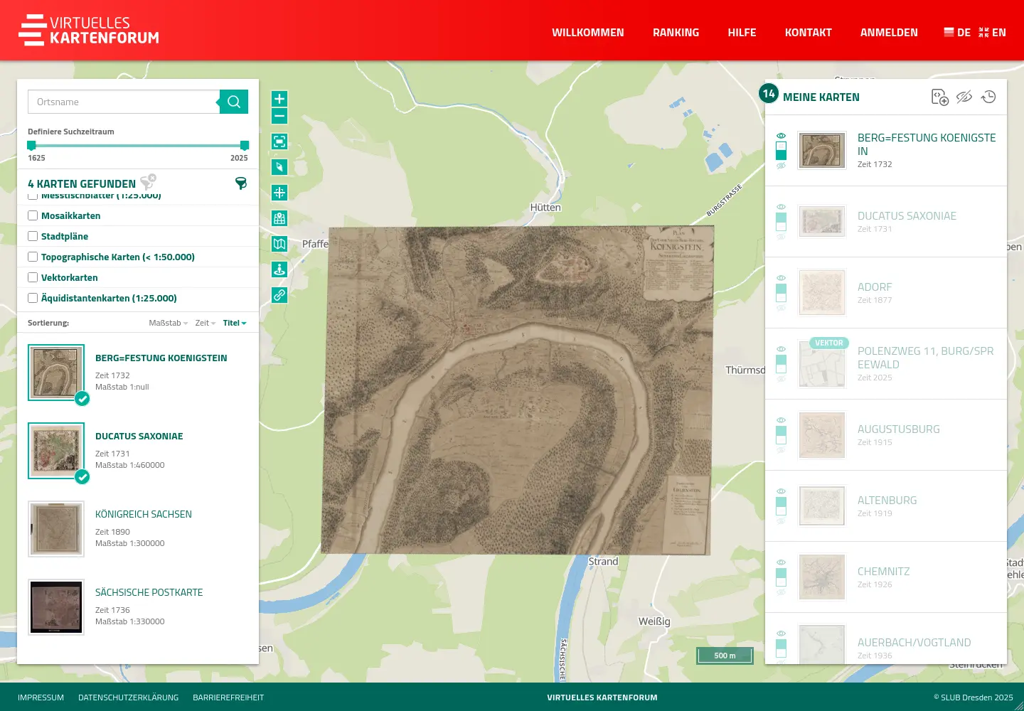
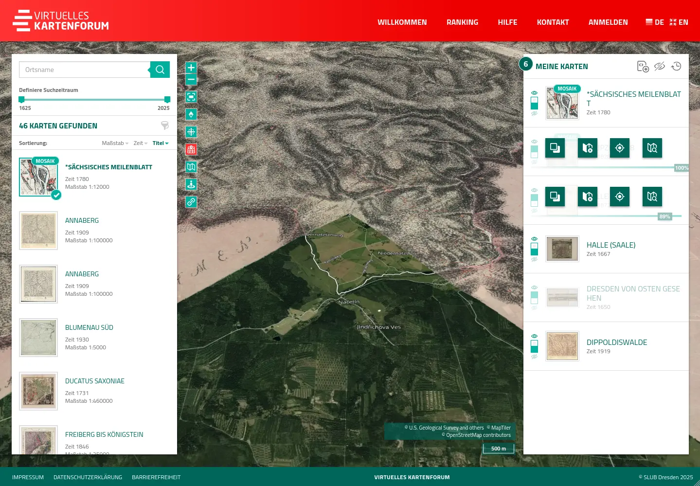
The Virtual Map Forum is a data platform for the exploration and inventory of historical maps and data. It includes tools for georeferencing historical maps, for collecting historical information and for researching, presenting and analyzing maps in 2D and 3D.
Project contents
PIKOBYTES has been continuously supporting the SLUB in the operation and development of the Virtual Map Forum since 2018. The open source application consists of an interactive web application for researching and exploring historical maps as well as a range of different web services for data management and data sharing. These include, for example, a REST API, a search index as well as web map services, web coverage services and tile map services for providing data to third-party systems.
Via a web application, users can research and display historical maps or information in 2D or 3D and easily download the data or integrate it into their own GIS solutions via standard interfaces. In addition, tools for georeferencing and maintaining data sets support registered users in the management of the map data of the Virtual Map Forum.
As the map forum contains historical maps for the whole world, worldwide base map services on the basis of OpenStreetMap and a global terrain dataset have also been created and set up for operation. A place name search, based on Nominatim, increases the ease of use of the map application and makes it easier to find regional historical maps.
The Virtual Map Forum is an open source project and the code is published on GitHub.
We rely on a sophisticated combination of proven methods and innovative technologies to not only implement projects, but to make them successful in the long term. Our strength lies in the intelligent combination of experience and progress – from established standards to state-of-the-art digital solutions.We use the following methods and technologies for the Virtual Map Forum: