A map of Germany showing emergency networks, with colored areas representing regions covered by different networks.
Emer­gency Map for KEK
The interactive map visualizes the number and location of emergency networks in Germany and provides information and capabilities on the participating institutions. All alliances can be filtered by category; a search is possible by the name of the institution as well as by location. The quantitative development of the networks from 1995 to the present day is shown in an interactive timeline.

Project contents

The interactive map application was developed by PIKOBYTES on behalf of the KEK. It was implemented as a single-page application and supports different end devices (mobile, tablet, desktop).
A map section shows a colored area. Several icons can be seen on this area. One icon is highlighted and labeled “Thüringer Landesmuseum Heidecksburg”.
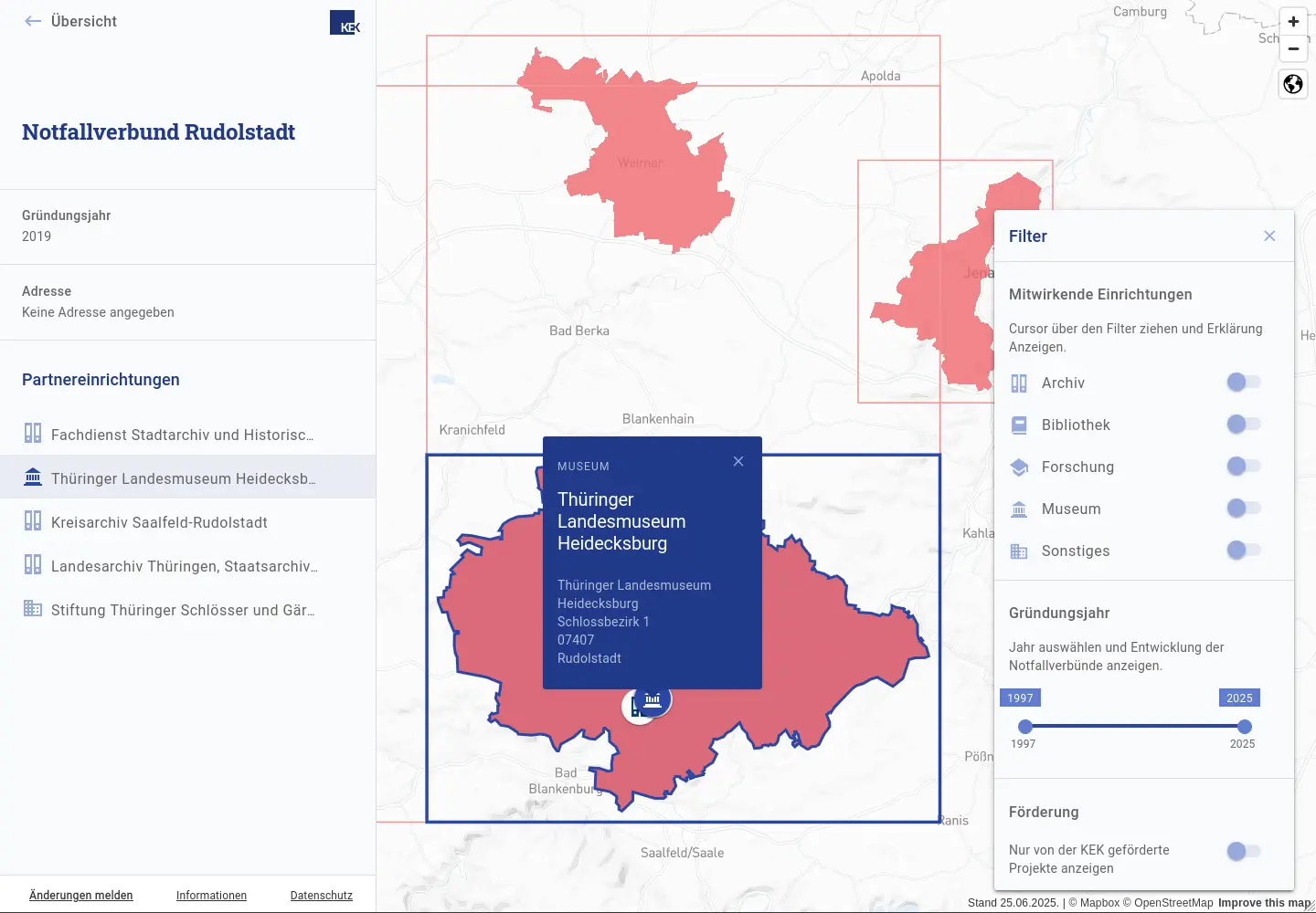
After an initial analysis of the data with corresponding automated data preparation, PIKOBYTES developed the design of the application in consultation with KEK. In the course of implementation, the application was then integrated into the KEK's CMS. In 2024, the application was expanded to include a back office for maintaining the data.
All alliances can be filtered by category; a search is possible by the name of the institutions as well as by location. The quantitative development of the associations from 1995 to the present day is shown in an interactive timeline.
Go to KEK Emergency Maps

Technology

We rely on a sophisticated combination of proven methods and innovative technologies to not only implement projects, but to make them successful in the long term. Our strength lies in the intelligent combination of experience and progress – from established standards to state-of-the-art digital solutions.We use the following methods and technologies for the KEK Emergency Maps:
Python FastAPI
ReactJS
MaterialUI
MapLibreGL
PostgreSQL
+49 (0)351 850 901 00